This website’s data is available at the geographical levels for which it is published, therefore not all data will be available at all levels.
The geographies you will find on Worcestershire Insights:
- Middle Super Output Areas (MSOA)
- Lower Super Output Areas (LSOA)
- Upper Tier Local Authorities (UTLA)
- Wards
- Districts
- Region
- Country (England)
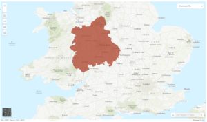
Region
Worcestershire is within the region of the West Midlands.
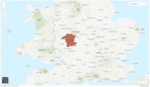
Upper Tier Local Authorities (UTLA)
The Local Authority of Worcestershire has a 2 tier (county and district) level to local government.
Districts
There are six districts within Worcestershire; Bromsgrove, Malvern Hills, Redditch, Worcester, Wychavon and, Wyre Forest
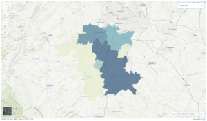
Find out about Worcestershire’s Districts using the data themes on the Homepage to create a Report or a Map.
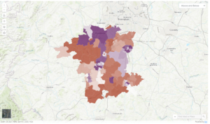
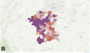
Wards
There are 124 wards in Worcestershire. These Electoral Wards are the spatial units used to elect Borough Councilors.
Find out about the population characteristics of Worcestershire’s Wards using the Quick Ward Profile on the Homepage; or create a Ward Report or a Ward Map for a Data Theme.
Output Area (OA)
Output areas (OA) were created for Census data.
Super Output Areas (SOAs) were designed to improve the reporting of small area statistics and are built up from groups of output areas – several OAs make up a Lower Super Output Area (LSOA); OAs and LSOAs can be aggregated to make up a Middle Super Output Area (MSOA)
More information on census geographies can be found here.